We left early in the morning for Wellington, hoping to catch the ferry at 2 to the south island. It was a four hour drive that took us through more rolling hills, the high country (for the north island), and finally along the coast as we neared Wellington. As forecasted, it was wet and windy in Wellington.
The ferry service we rode was Interislander and it is the lifeline for connecting the north and south. The ferry transports not just tourists and camper vans but also the trucks and semis moving goods between the islands.
Most rental car companies treat the north and south islands as separate countries, so we had to leave our car at the terminal and pick up a new one in Picton on the other side.
The overall experience felt closer to a cruise than a ferry. We checked our bags and sat in the terminal with other passengers waiting to be called. On board, they had a small cafe, bar, multiple decks, and even a movie theater We initially chose a pair of seats near the cafe but with a view where we could enjoy lunch.
Once we got out of the protected harbor and into the strait we noticed that the ship was slanted to the left, but not rocking (see picture). The waves were rolling in from our right and hitting the boat, splashing up onto the windows on the second deck.
It took about two hours to reach the Marlborough sounds, which allowed us some time to catch up on our posts. Once we got into the sounds the boat was steadier, but the rain picked up and continued non-stop for the remainder of the voyage. Nate snuck outside a few times for pictures but never stayed long.
Getting our luggage was easy and similar to an airport. We found the Hertz and ended up with a red 2013 Camry, the same make/model/color as on the north island. While checking in, we also grabbed a few maps and pamphlets - our collection continued to grow.
It was a short, but rainy 30 minute drive to Renwick in the middle of wine country. As if on cue, the rain stopped when we were only two minutes from our b&b. Olde Mill House had 15 steps up to the house through one of the prettiest gardens we've seen. Robert and Diane (owners) greeted us and took us to our room with a view of the garden. Once settled, they provided maps of the area, recommended activities and wineries, and places to eat.
We drove to Blenheim for dinner at Raupo and got a chance to see some of the wineries from the road, some which had sheep grazing amongst the wines. Dinner was good and reminded us of restaurants in Napa.
Tomorrow we would get picked up on Bubbly Grape Tours and get a chance to sample some wines and see the area.
One of the reasons we chose Adventure Lodge & Motel is that they had an Alpine Crossing package that included shuttle drop off and pick up, hot breakfast, packed lunch, and dinner. In other words, an all inclusive type lodging experience. Since there aren't too many amenities in the area, having meals provided gives you one less thing to worry about. Plus, you cannot park at the trail head so you need to arrange a shuttle drop-off unless you wish to add another 15 kilometers to your hike.
It was an early morning with a hot breakfast at 6 am for the 12 of us that would be hiking the Alpine Crossing today. Conditions still looked good, so we would be leaving at 6:30 in order to get an early start on the trail and hopefully beat any inclement weather.
Lorraine dropped us off at 7 and told us to hike up, look around, do a summit (if able), and hike back down by 3:30 for the late shuttle back. Because of the eruptions in August and November of 2012, the northern side was off limits to hikers until scientists gave the okay that no further eruptions were imminent. On a positive note, the section open was supposed to be the "better half" of the hike and would still total out to around 17 km.
The first hour to hour and half to Soda Springs was 4 km through moderately vegetated bush and along boardwalks at a gentle incline. The morning was cool, so we had started with multiple layers, but by the time we reached this point we were stripping jackets and fleece. Soda Springs would also be the last bathroom facilities until the return trip on the way back.
It was after Soda Springs that the terrain changed to consistent black lava rock and the serious elevation change began in the section called the Devil's Staircase. This section, as you could guess, had many steps climbing upward interspersed with an inclining path that lasted nearly 2 kilometers. The total elevation change for the trail is 800 m (2500 ft), with the Devil's Staircase and later the Red Crater making up most of that change.
Just when we thought we could spy the end of this section, another set of stairs would emerge. It was strenuous work moving consistently uphill, but we began to notice a cool breeze the higher we got which was helpful. After a long climb of over an hour we reached the top of the Devil's Staircase and enjoyed the expansive views over the valley that we had just hiked.
The next section was the wide and flat South Crater. We passed Mt. Ngauruhoe as we entered the crater and noticed just how steep of an ascent it became. Near the top, it was close to vertical and required hands over feet scrambling.
Crossing this wide crater (~1 km) the breeze turned into an increasingly stronger wind, creating and sending small sand "waves" across the path. Since temperature was dropping, we got our jackets and fleece back out to relayer. Once across the crater, the wind was very strong and took some effort to stand up straight for pictures.
Next up was the ascent to red crater, the highest point on the trail at 1890 m. There were also two other optional side track summits, Mt. Tongariro (only 100 m higher), and Mt. Ngauruhoe. Mt. Tongariro adds another hour and Mt. Ngauruhoe another 2.5 to your hike if you decide to summit.
Mt. Ngauruhoe is also best known as Mt. Doom from the Lord of the Rings movies. It has the typical conical look that most think of for volcanoes and is very steep near the top. Not many end up attempting this, and those that tried on our hike looked to be making very slow progress.
The red crater ascent was the toughest of the day. The wind was very strong and the gravel on the path was loose and steep. This is where we first started to notice people heading back down, and most told us that the top was too windy to want to stay long. With estimated wind gusts over 50 mph, we saw several hats a jacket, and even a roll of toilet paper get ripped out of hands and sent into the crater. Due to the narrowness of the ridge, the steepness of the trail, and the slippery terrain, we had to brace ourselves against large boulders during the stronger wind gusts. Other hikers literally sat down where they were standing when the wind blew. After many breaks, holding onto large rocks during very strong gusts, and words of encouragement (mainly Nate convincing Ashley that she would not become a kite), we reached the red crater. This "small" stretch took well over an hour to get up - constantly slipping and fully exposed to the wind. The top actually felt calmer, but not enough for us to want to stop for lunch.
The red crater was just beyond the flat area and it was a steep drop off near the continuing path. It also must have been a repository for hats, jackets, and other lightweight items due to the high winds.
We wanted to see the emerald lakes (as far as we could go due to closure caused by the eruption), so a few more minutes up another steep and narrow but less slippery incline took us to a crowded viewpoint for some pictures.
We were literally above the clouds as we looked across the crater and beyond the emerald and blue lakes. After getting enough pictures to prove we made it, we decided to start the descent since weather seemed to be worsening and we didn't want to miss the shuttle pickup.
We took our time coming down from red crater since the trail was slippery and the wind was strengthening. Both of us lost our footing a couple times, but only Nate ended up on his backside. By this time, fellow hikers were turning around before even making it to the red crater.
Reaching the south crater was a relief, but winds were driving sand across the long flat area. It wasn't until we crossed to the start of the Devil's Staircase that we got some relief from the wind. Because hikers were just reaching the top of that climb and had had less wind, we saw many in shorts and no jackets (and one pair of sandals). There were even some kids hiking up, which seemed a little dangerous. The hike down the Devil's Staircase was much easier, and we both shed layers during the descent.
There was a stream and waterfall near Soda Springs that we had skipped on the hike up. This made the perfect lunch picnic spot once we found a secluded bunch of rocks.
We were going to have to hurry to make the early shuttle, so we decided to take our time and catch the late shuttle. This meant we fully got to enjoy the scenery, which was shaded during our early morning hike the other way.
It was a leisurely walk through the bush on the way down, arriving back at the start around 2:30.
Once on the shuttle, Lorraine told us that the 65 year old on our shuttle in the morning had summited Tongariro by 10 and made the early pick up. Crazy Kiwi made us feel old and out of shape.
Overall, we are very happy with the experience. It would have been nice to complete the whole trail, but we did reach the highest point. The wind was a challenge, but we both feel fortunate that we were able to go. The day before had been cancelled and the next day was not looking good. Looking back, we probably had enough time for the Tongariro summit, but so few were going up, the wind was strong, and we did not want to miss the shuttle.
It was the most physically and mentally draining hike we've done so far, but completing the portion we did was so satisfying. We would definitely recommend this to anyone considering this as a stop on the northern island.
Once back at the hotel we enjoyed some time in the hot tub and our steak dinners. The group shared war stories from the day's adventure at the American table (segregated from the British) and also got our completion certificates and t-shirts.
After dinner, we got one last unique view of Mt. Ruahepu, with a lenticular cloud hovering above.
With sore feet and bodies, it didn't take long for us to get to sleep this night. Tomorrow we would be heading south for Wellington and the ferry to the South Island.
Our morning began with a wonderful breakfast (coconut pancakes!) served by Liz. Another American couple joined us, and we chatted about our trips, driving on the "wrong" side of the road, and where to next. Dave had to stop and remind us that we had to leave if we were to see the geyser at Wai-o-tapu, their top choice for geothermal parks in the area. After saying our goodbyes, we packed up and headed to Wai-o-tapu.
Rotorua has numerous geothermal parks to visit. However, unlike the United States, most of the areas are privately owned rather than national parks. So each visitor must pay an entry fee that ranges from $20 to $50 depending on the park. Our hosts highly recommended Wai-o-taupo for the most bang for your buck, plus they provided a 10% off coupon.
We arrived at the thermal park just a few minutes prior to the scheduled geyser eruption. After purchasing our tickets, we were directed to the parking lot closest to the geyser. With seemingly seconds to-go before the 10:15 scheduled eruptions, we joined the other tourists in bleacher seats.
Up walked a "ranger" over the barricade to stand next to the Lady Knox geyser. He nonchalantly started providing a history of the geyser, which was one of only 15 active geysers in New Zealand. After a few minutes talking he paused and took out a small brown pouch and poured it down the geyser's cone. Apparently, they intervene in the periodic eruption cycle for the tourists. The typical natural cycle is 24 - 72 hours, but in using an eco-friendly soap they can force an early eruption. Feeling like an "Easy" button was used, we were a little dejected as we waited.
The water slowly began to pour over the hole, and another 15 seconds later water was shooting up 30 feet. Unfortunately, because their hadn't been much rain, the geyser lasted only 2 minutes. The geyser wasn't as impressive as Te Puia the day before, but the rest of the park was supposed to be very good. And that's exactly where a few hundred people were heading after the short eruption.
The park had 25 or so named geothermal features, and we decided to walk the 75 minutes or so to see them all. Most names were of course hell themed such as inferno crater and Devil's bath. The paths and boardwalks were well maintained between the highlights and the signage good throughout. As a visitor, you quickly get used to the smell of sulphur.
One of their more well known areas is the Champagne Pool (similar to Prismatic Pool in Yellowstone). Around the edges, orange and yellow colors exist due to the algae living in the hot waters. A heavy steam came off the water and frequently blew towards the small crowd of viewers.
We did the whole of the park which took us along boardwalks, through trees, expansive views over Frying Pan Flat, down to Lake Ngakoro, and then back again to the Champagne Pool.
The last stop before exiting was at Devil's Bath. This was a delightful yellow-green pool of water that was bubbling in several spots. The naming of these features was usually not all that inventive once the theme of 'hell' was decided upon.
Leaving the main park, we made sure to stop at the mud pools. We had been told they were the largest in the area and we were not disappointed. Some of the sections slowly built up pressure like a balloon expanding, while others would be dormant for a minute or two before sending mud several feet up and out. We watched the bubbling and sometimes exploding mud pools for 10 minutes before heading for Taupo.
Overall, we enjoyed Wai-o-tapu more for its varied and quantity of geothermal features. However, Te Puia's geyser was more impressive and the Maori cultural information was informative for those with an interest in anthropology and history.
Lake Taupo and the corresponding town of Taupo sit near the center of the north island. We stopped for lunch, hiking socks (all were dirty at this point), and gas. Based on the pamphlets and talking to a few locals, it seemed like a good stop for a few days the next time we make it back.
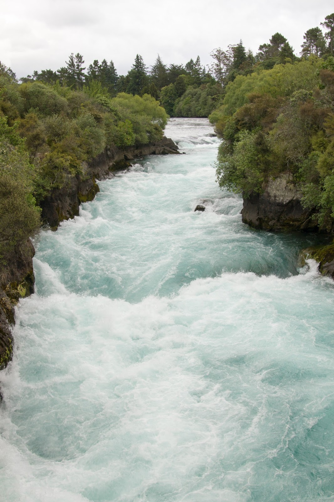
After lunch we went to Huka Falls, one of the most visited places in New Zealand and is the river barrel escape scene from the Hobbit (Desolation of Smaug). The water is forced through a narrow slot creating rapids for the light blue water.
One of the adrenaline activities was to jetboat through these, but we never saw that boat. It was a nice scenic way to further break up our drive to Tongariro.
The purpose for heading to Tongariro was to do the Alpine Crossing, a nearly 20 km hike into volcanic terrain that is often cited as the best one day hike in New Zealand. However, in August and November eruptions ocurred that had a blast radius overlapping the trail. This meant that parts of the trail were still closed, and we were hoping to hear good news regarding status.
The drive to Tongariro was another 2 hours or so, mostly in the rain. As we crossed the final ridge we quickly realized there wouldn't be views of the volcanoes any time soon as they were hidden behind clouds.
We pulled into our lodging at Adventure Lodge & Motel in National Park and checked in. We chatted with the owner Lorraine and learned that the trail still wasn't fully opened, but more importantly that today's weather resulted in cancellations of all Alpine Crossing hikes. Tomorrow was supposed to be clear in the morning, but we'd have to leave by 6:30 to beat the winds.
With that news, we went to dinner. As a good omen (hopefully), the skies cleared as we were eating and we finally saw Tongariro, Ngaurahoe (Mt. Doom), and Mt. Ruahepu.
Feeling hopeful (and full), we decided to drive up Mt. Ruahepu to check out the views. With near empty roads, Ashley was able to experience driving on the 'other' side of the road as we climbed the switch backs to the ski base. We left most of our warm clothes back at our lodge, so we didn't last too long once we got out. We did, however, scope out Tongariro and Mt. Doom for tomorrow's hike.
Cold and tired, it ended up being another early night. Tomorrow would be a long, hard hike and we needed our rest.